
4-Xtremes – Part 60: Right up to the North Pole with the Axor
Series: 4-Xtremes – The World Tour
From the Orkneys, Andrea, Mike and the Axor head further north. To fjords and abandoned settlements, with tiny ferries – and finally to a space port under construction. But read for yourself!

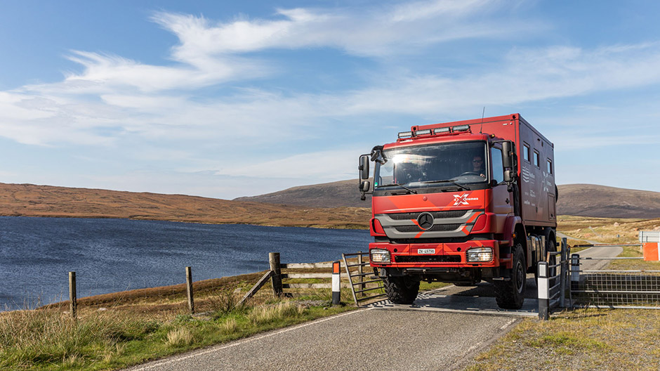
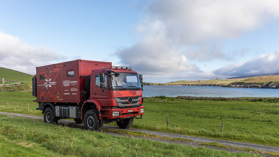
Will it fit? Yes, the Axor reaches the island of Unst without any "roof damage" on the mini ferry.
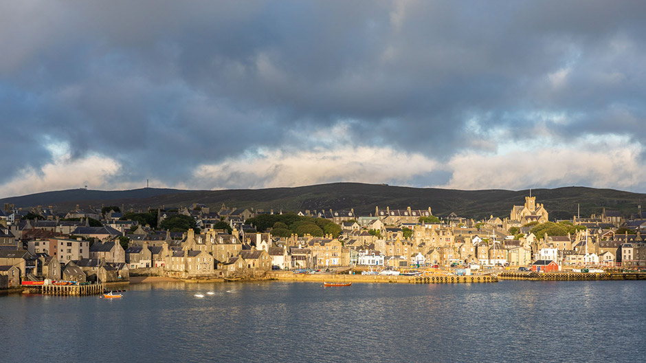
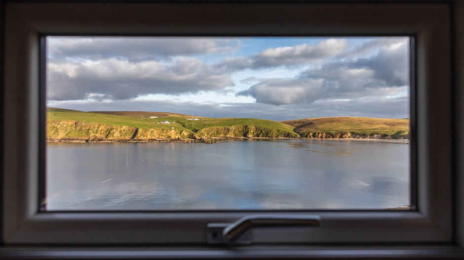
Leaving Kirkwall, Orkney at the witching hour and heading north, the ferry took us a full seven hours. Our destination after a smooth journey and sunrise on deck? The port of Lerwick on the main island of the Shetlands – which, like the Orkneys, are part of Scotland and, at the same time, the northernmost region of Great Britain.
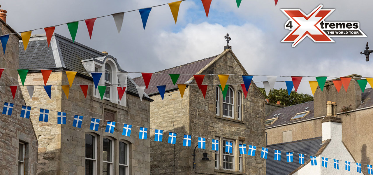
Since we are already awake, we decide to take a walk through Lerwick, the main town of the Shetlands with around 7,500 inhabitants. Sandstone buildings line the waterfront, most dating back to the 18th century. We stroll down the practically deserted, narrow main road that follows the coastline. The harbour is modern, and there is a lot to see, from fishing boats to private sailing yachts to big vessels such as the ferry on which we arrived.
Even more remote than the Orkneys.
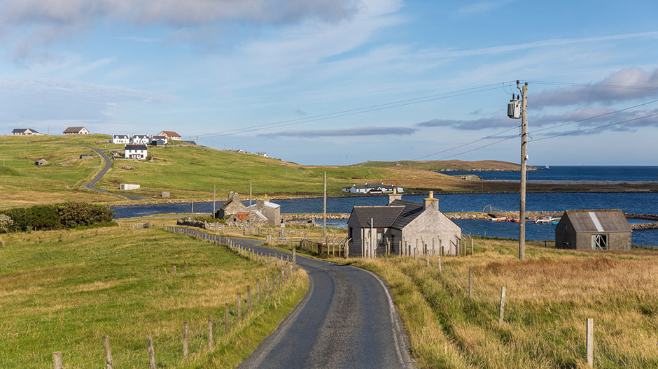
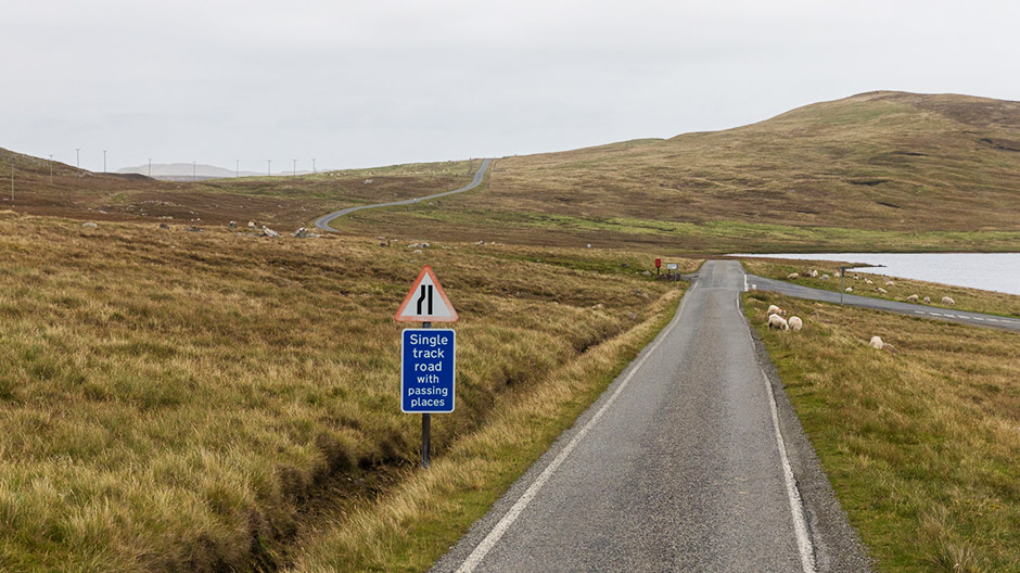
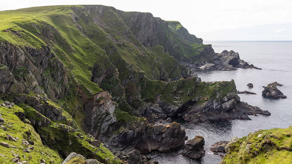
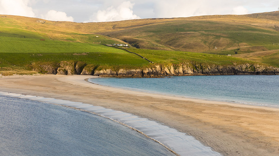
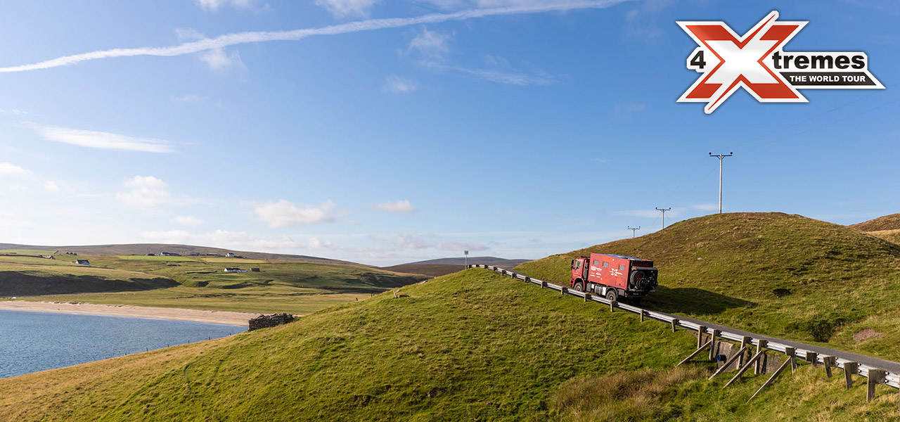
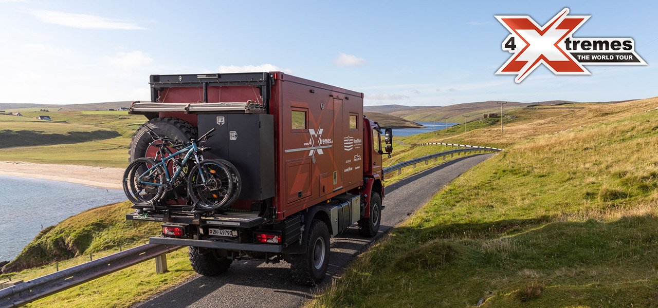
The Shetlands stretch over an area of around 80 by 120 kilometres between the 59th and the 61st degrees of latitude. The islands are broken up by numerous "voes": bays or creeks that were formed during the last ice melt around 12,000 years ago. For us, this means that it isn't so easy to plan a route that doesn't involve constantly driving back and forth.
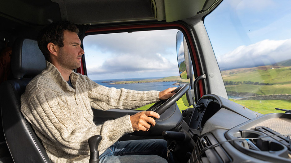
Shetland feels even more remote from the rest of the world than the Orkneys. Maybe that has something to do with the voes, but definitely because the islands are even less densely populated. The road infrastructure is impeccable, so we always have a clear run with the Axor. But a "clear run" also means that you are often alone on the road.
Brick building in Lerwick, colourful street art, and many abandoned settlements.
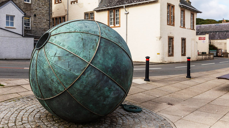
Brick building in Lerwick, colourful street art, and many abandoned settlements.
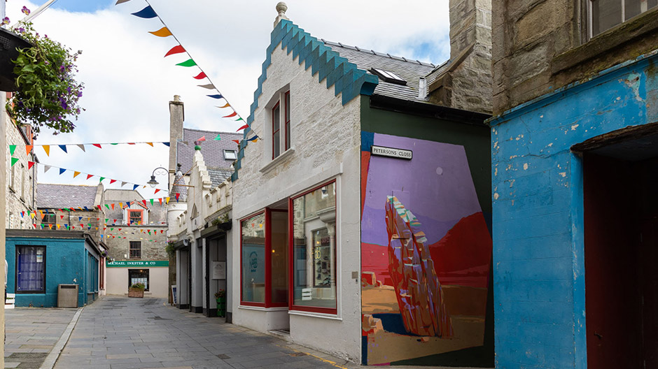
Brick building in Lerwick, colourful street art, and many abandoned settlements.
Brick building in Lerwick, colourful street art, and many abandoned settlements.
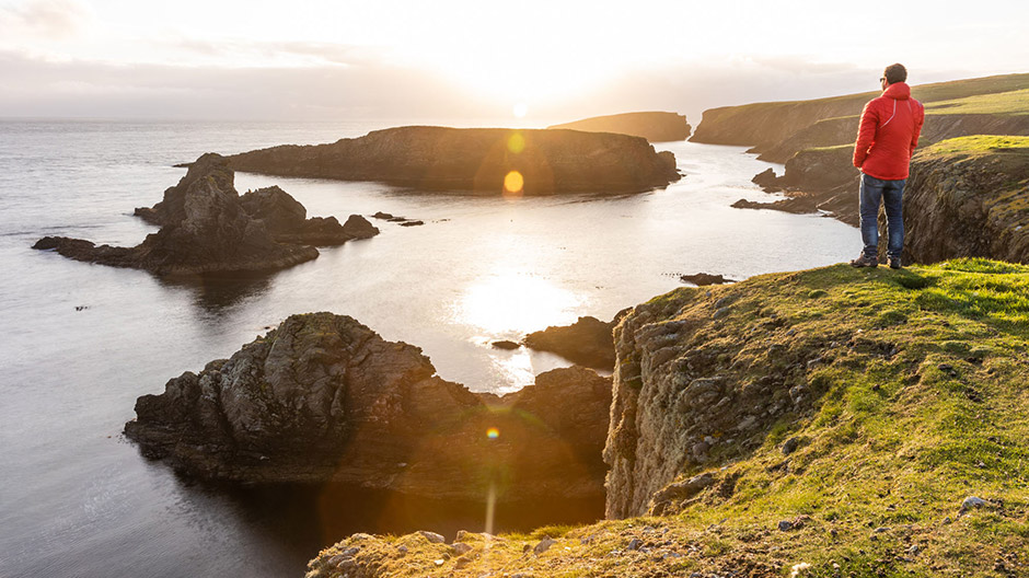
Lighthouses on every corner.
The lighthouses, which are literally on every corner, are real eye-catchers, dramatically situated on cliffs. We explore a number of these cliffs on foot – and we have to be careful not to be blown away by the wind. On one hike, a gust of wind rips the camera’s sun visor out of my hand. On some days, the wind reaches up to 100 kilometres per hour. It then becomes important to position the Axor with the rear as far into the wind as possible so you can have a reasonably quiet night without any rocking.
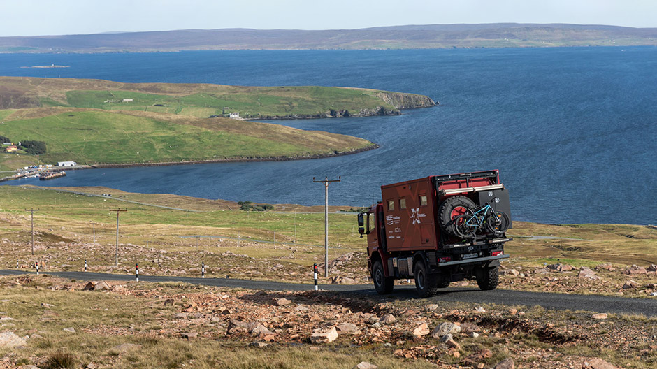
When you explore the coast, you come across countless bays with ruins from fishing settlements, some of which were used since ancient times – up until the 20th century. One of these abandoned settlements is Fethaland on the northernmost tip of the main island. From here you can go even further north: with two small ferries, which travel just fifteen or seven minutes.

Smallest ferry – and a lot of "northernmost".
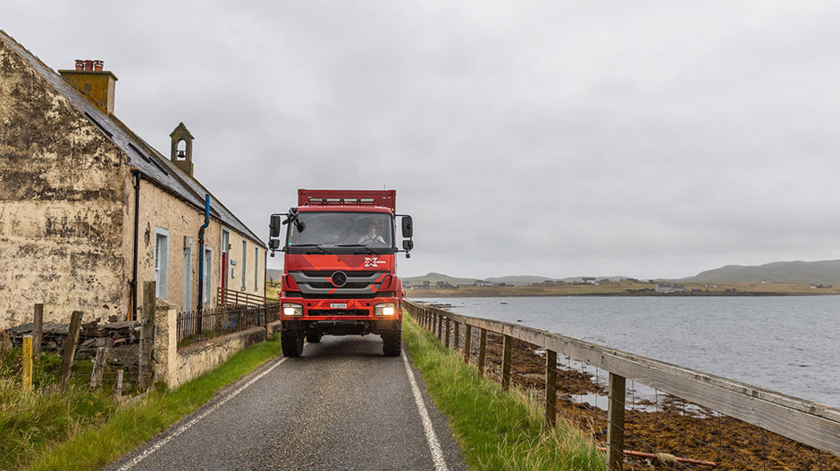
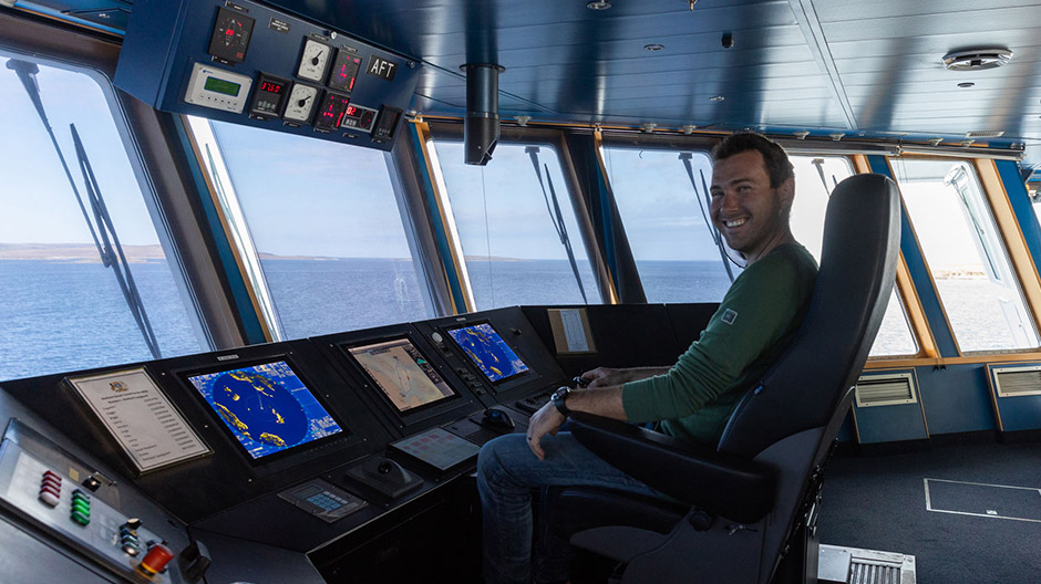
On the first ferry – to the island of Yell – we are invited to the bridge by the crew, and Mike is even allowed to try out the captain’s chair. After a 20-minute drive along Yell, we come to the second ferry. And it’s probably the smallest we’ve ever rolled the Axor onto. The maximum vehicle height is 4.20 metres, and the crew can't believe our truck can fit. But the boys aren't bureaucratic about it and simply say: "Give it a try, and if you hear it scratching, just stop". But of course we get on the ferry with our height of 3.70 metres without scratching – and then over to the island of Unst.
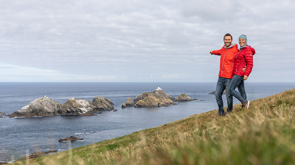
Unst is Britain’s northernmost inhabited island. And since we’re always on the hunt for "Xtremes", here are a few more: the northernmost house, the northernmost church and the northernmost lighthouse on the offshore islet with the beautiful name of Muckle Flugga – all specially marked on the map. Of course, the lighthouse works automatically, but by chance we meet one of the former lighthouse keepers: a real sea dog with plenty of wild stories about stormy seas.
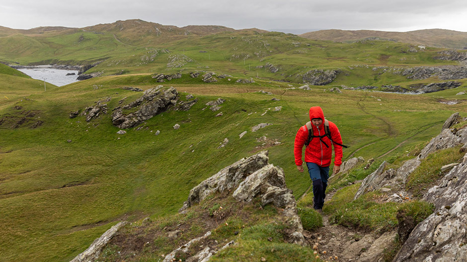
Climbing like in the Alps, all alone on the road – and plenty of sheep.
Climbing like in the Alps, all alone on the road – and plenty of sheep.
Climbing like in the Alps, all alone on the road – and plenty of sheep.
Climbing like in the Alps, all alone on the road – and plenty of sheep.
Climbing like in the Alps, all alone on the road – and plenty of sheep.
Climbing like in the Alps, all alone on the road – and plenty of sheep.
Climbing like in the Alps, all alone on the road – and plenty of sheep.
A trip into space? Soon possible from Unst.
And then there’s another quite extraordinary site on Unst: the "SaxaVord UK Space Port", a space port under construction. Small rockets will be catapulted into low orbit from here in the future. Unfortunately, you don't see much here. But at least the "deterrent" sign warning you against entering the construction site, is very amusing: All aliens caught here will be reported to the Space Police and transported to Mars.
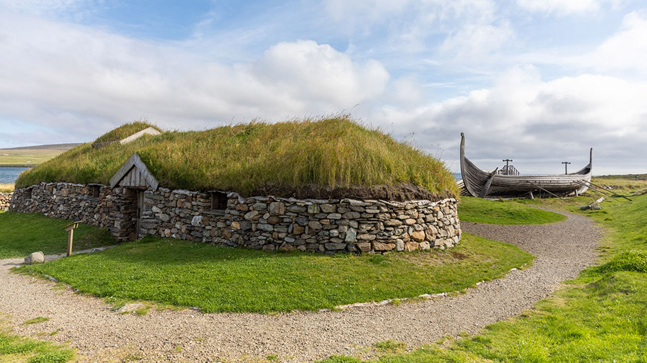
As a contrast to this place of the future, you can visit a replica longhouse and a Viking ship nearby. The Vikings ruled Shetland for almost 700 years, and their traces can still be found today.
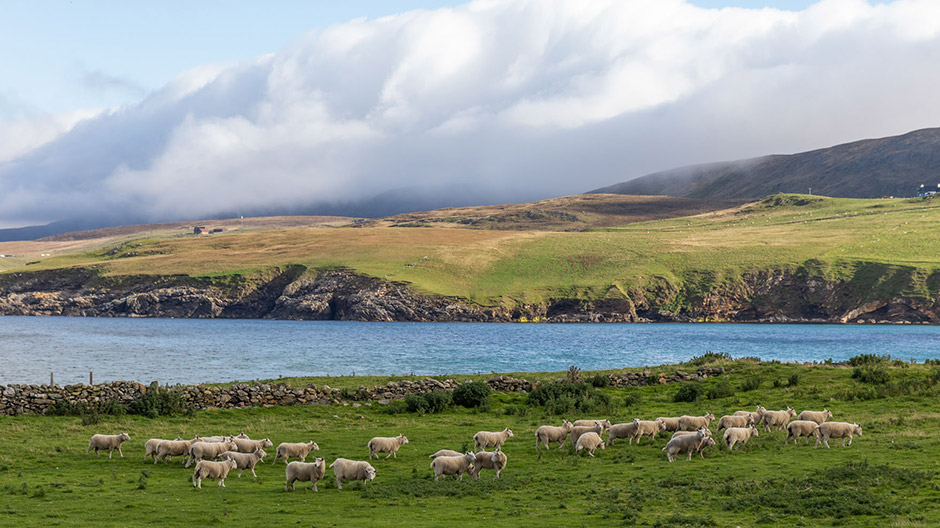
Looking north from the Muckle Flugga lighthouse, the next stop would be the North Pole. As we know our Axor can't swim, we have to turn around! Back to Shetland’s main island with the two little ferries. As we've seen more sheep than people in the past few weeks, it’s time for a bit more socialising.
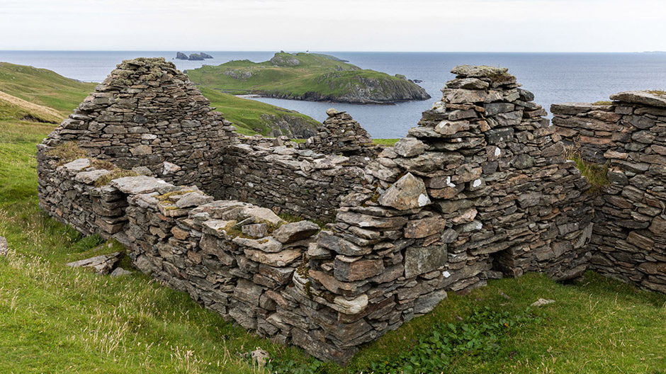
Even after 700 years, the traces of the Vikings can still be found everywhere on the island of Unst.
Even after 700 years, the traces of the Vikings can still be found everywhere on the island of Unst.

Even after 700 years, the traces of the Vikings can still be found everywhere on the island of Unst.
But more about that in the next episode.
4-Xtremes – The World Tour.
An unparalleled journey.
Andrea and Mike Kammermann have been on tour in their Axor for three years. "4-Xtremes – The World Tour" is the motto of the journey that the two Swiss nationals embarked on in mid-2020 and which they share with the RoadStars community. Keep up to date and don't miss out on any of the stunning destinations visited by the adventurous pair.
You can find the current parts from the “4-Xtremes – The World Tour” series here.
You can find the route of the trip before the crossing to South America here.
Photos: 4-Xtremes


Comment
Please log in to post a comment.
12 comments
und das mit dem Axor auf der kleinen Fähre 👍😂
Macht weiter so
Gruss Andreas
und das mit dem Axor auf der kleinen Fähre 👍😂
Macht weiter so
Gruss Andreas
Liebe Grüsse von uns
Liebe Grüsse von uns
Ich verfolge Euch nun ja auch schon eine ganze Weile und ich bin es nicht müde Eure Reportagen zu lesen und freue mich immer auf Neue!!!
👍👍👍👍👍👍⛟😎
Ich verfolge Euch nun ja auch schon eine ganze Weile und ich bin es nicht müde Eure Reportagen zu lesen und freue mich immer auf Neue!!!
👍👍👍👍👍👍⛟😎
Viele Grüsse von uns
Viele Grüsse von uns
Einfach wieder toll Eure Reise ein Stück weiterverfolgen zu können, danke dafür 👍👏
Einfach wieder toll Eure Reise ein Stück weiterverfolgen zu können, danke dafür 👍👏
Es macht unheimlich Spass unsere Erlebnisse und Bilder hier teilen zu können 😃.
Viele Grüsse von uns
Es macht unheimlich Spass unsere Erlebnisse und Bilder hier teilen zu können 😃.
Viele Grüsse von uns
Liebe Grüsse von uns
Liebe Grüsse von uns
Liebe Grüsse von uns
Liebe Grüsse von uns
So unwirtlich die Gegend auf den ersten Blick wirkt, so anziehend ist auch die unberührte Natur und das Farbenspiel.
Und so sehr man sich im Alltag nach Ruhe sehnt, so gut kann ich verstehen, daß ihr nach mehreren Wochen Einsamkeit mal wieder Lust auf Leute habt. 😄
Wir wünschen euch weiterhin eine gute Reise und sind gespannt, wo es euch als nächstes hinverschlägt... 😍
Die Shetland Inseln sind wirklich eine tolle Reise Destination und haben einen guten Mix von atemberaubender Landschaft und Kultur. Die Insel kommt auf unsere Liste von "Orten die wir nochmals besuchen wollen". Google mal "Up Helly Aa". Dafür müssten wir mal im Winter nochmals hinfahren.
Liebe Grüsse von uns :)